Normandy carries weight in modern history. The D-Day beaches and memorials draw visitors from across the world, and they should — the landscape holds memory in concrete bunkers and cemetery rows. But reducing Normandy to wartime sites misses a region defined equally by pasture, apple orchards, half-timbered towns, and a coastline that shifts from chalk cliffs to tidal flats depending which direction you drive.
Two Coasts, Different Characters
Normandy's English Channel coast includes the iconic cliffs at Étretat — natural arches and needle formations that appear in paintings by Monet and Courbet. Further west, the Cotentin peninsula wraps around Cherbourg with a more austere, wind-exposed character. The Alabaster Coast (Côte d'Albâtre) between Le Havre and Dieppe offers fishing ports and beach towns that fill with Parisians in summer but remain working coastlines year-round.
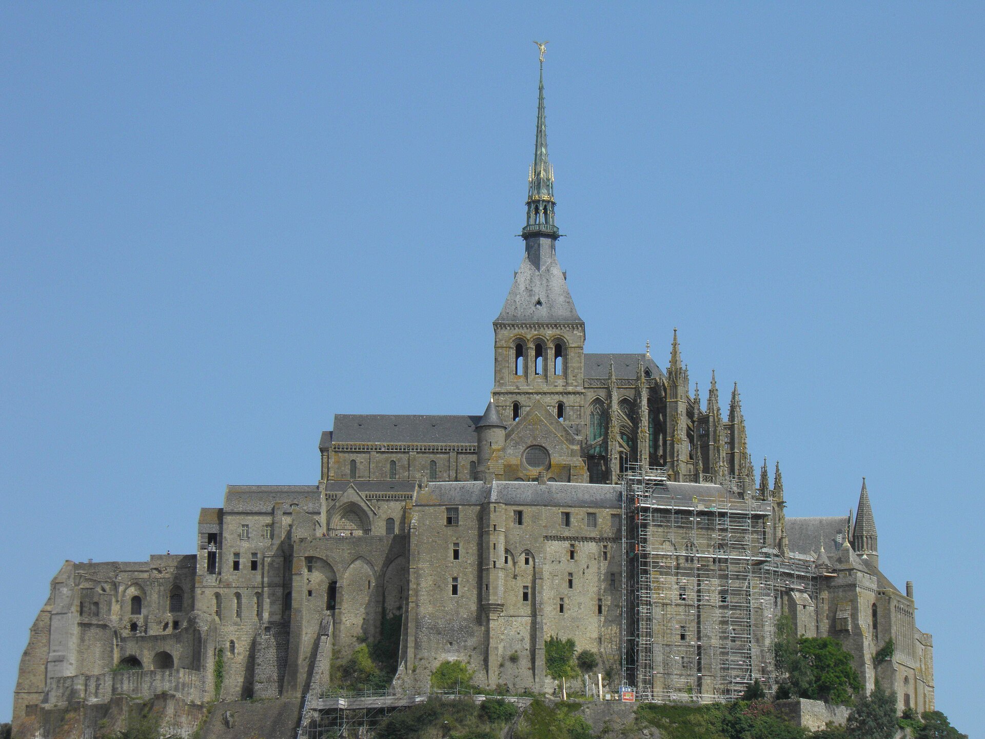
Near the border with Brittany, the tidal abbey of Mont-Saint-Michel rises from the bay in Normandy's Manche department — a UNESCO World Heritage site and one of the most visited landmarks in the country. Crowds peak mid-morning in summer; early or late visits change the experience considerably. Tide schedules govern safe access to the bay; walking the sands without understanding tidal movement has caused serious accidents.
Inland: Pays d'Auge and Apple Country
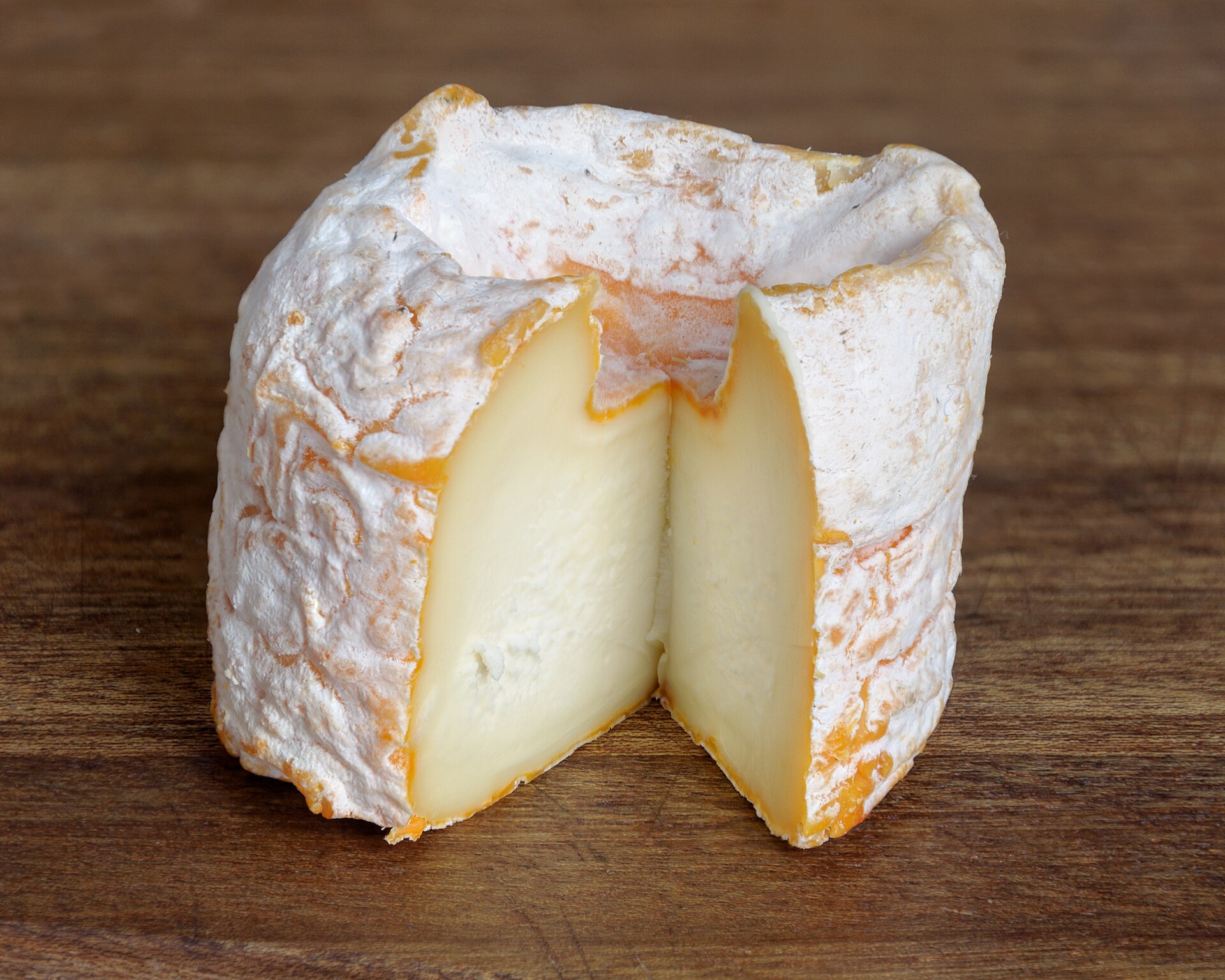
Move inland from the coast and Normandy becomes dairy and orchard country. The Pays d'Auge, south of Deauville and Trouville, produces Camembert, Livarot, and Pont-l'Évêque — cheeses worth seeking at local markets and fromageries. Apple orchards supply cider (cidre) and the apple brandy Calvados. Producers often welcome visits; look for signs indicating vente directe (direct sale).
Half-timbered architecture appears in villages like Beuvron-en-Auge and Lyons-la-Forêt. These are not museum sets — people live and farm here. Respect private property and stick to public paths when walking between villages.
Historic Cities
Rouen, the regional capital, combines a medieval core with a cathedral that held the tallest spire in France for centuries. Joan of Arc's history intersects the city at several sites. Caen offers William the Conqueror's castle and abbeys rebuilt after wartime bombing. Bayeux is small enough to walk entirely but holds the famous tapestry depicting the Norman Conquest — eleven centuries of narrative in embroidered cloth.
Honfleur, at the Seine estuary, attracts artists and photographers with its harbor front. It is picturesque and well aware of it — visit on a weekday if possible. Le Havre, rebuilt in modernist style after 1944, surprises visitors expecting only old stone; UNESCO listed its postwar architecture for a reason.
Food Identity
Normandy's cuisine reflects its agriculture: butter-rich sauces, cream, apples, and seafood. Dishes like teurgoule (slow-baked rice pudding), moules à la normande (mussels with cream and cider), and sole meunière appear on local menus. The region's food traditions connect to our broader guide on regional cuisine and specifically to Normandy cheeses.
Markets in Rouen, Caen, and smaller towns operate on weekly schedules worth checking before arrival. Saturday mornings remain the safest bet for a full selection.
Getting There and Moving Around
Trains from Paris reach Rouen in about 90 minutes and Caen in roughly two hours. Coastal and rural areas benefit from a rental car. Cycling is feasible in flatter sections — the Véloscénie long-distance route crosses parts of the region — but hills and weather require planning.
Normandy pairs naturally with a first trip to France when you want manageable distances from Paris and visible history without the intensity of the capital alone. Combine with our guides on seasonal travel — autumn orchards and spring pastures each offer distinct reasons to visit.
Walking and Coastal Paths
The GR 21 long-distance path follows the Alabaster Coast from Le Havre to Le Tréport, passing cliffs, pebble beaches, and fishing harbors over roughly 180 kilometers. You need not walk the entire route — day sections between Étretat and Fécamp or toward Dieppe suit afternoon hikes with bus return. Tidal flats near Mont-Saint-Michel and along the Cotentin offer different terrain: flat, exposed, and bird-rich rather than cliff dramatic.
Weather changes quickly on the Channel coast. Layer clothing, carry rain protection, and check tide tables if walking near beaches or the Mont-Saint-Michel causeway. The light that painters documented — mutable, silvery, sharp when storms break — remains one of the region's genuine draws, not a marketing phrase.